
Subsurface Utility Engineering & Detection
Locate, trace, and georeference buried cables and pipelines before excavation
Prevent catastrophic strikes to high-voltage lines, gas mains, and fiber optics with combined electromagnetic locators, ground penetrating radar, and high-precision GNSS mapping.

Field-to-Finish Engineering Workflow
Step-by-step field methodology from instrument setup to digital CAD/BIM deliverable.
Transmitter Direct Connection
Apply precision frequency signal to target pipe or conductor with Radiodetection TX-10 high power generator.
Receiver Sweep & Depth Mapping
Trace utility centerline with RD8200 receiver, logging continuous depth and current measurements.
Centimeter Geotagging
Pair locator via Bluetooth to Leica GS18 GNSS to log sub-centimeter GPS coordinates for GIS utility registries.
Included Equipment & Sensor Bundle
High-precision hardware, accessories, and field controllers architected for this specific solution.
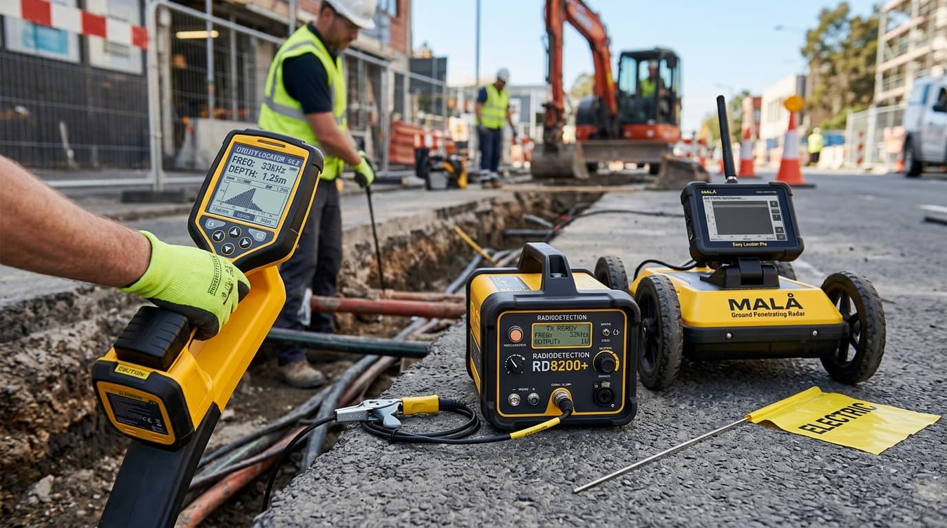
Radiodetection RD8200 Precision Pipe & Cable Locator
No compromise damage prevention locator
Industry gold-standard underground cable and pipe locator with industrial noise suppression and swing warning system.
Simultaneous depth and current readout on target line

Leica GS18 T RTK GNSS Smart Antenna
The fastest, immune-to-magnetic-interference tilt-compensating GNSS
Revolutionary calibration-free tilt GNSS smart antenna. Measure points without leveling the pole, speeding up topographic stakeout and boundary surveys by over 30%.
Calibration-free IMU tilt compensation up to 30°+ tilt angle
Primary Industry Sectors
Tailored workflows deployed across critical civil infrastructure and metrology

Public Utilities & Underground Assets
Protect power grids, telecommunications lines, water systems, and gas pipelines with electromagnetic cable locators, ground penetrating radar, and centimeter GNSS mapping.
Explore Industry
Civil Engineering & Heavy Construction
Equip earthmoving and commercial building teams with rugged dual-grade lasers, 3D machine control guidance, and automated stakeout total stations engineered for harsh dusty site conditions.
Explore IndustryNeed Custom Modifications or Financing?
Our factory-trained application specialists can modify sensor payloads, configure custom GNSS antenna baselines, and assemble institutional lease-to-own terms.