GNSS RTK Systems & Smart Antennas
High-precision GNSS RTK smart antennas, rovers, and multi-constellation base stations.
Certified factory hardware with ISO 17025 accredited calibration and warranty support.
Precision Instrumentation for Demanding Field Operations
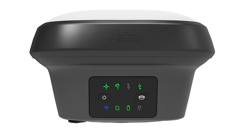
Leica Geosystems and GeoMax GNSS receivers offer the ideal satellite positioning system for every surveying and civil construction application. Featuring calibration-free inertial measurement unit (IMU) tilt compensation, modern rovers measure inaccessible edges, building corners, and steep embankment contours without holding the pole vertical.
Multi-frequency tracking across GPS, GLONASS, Galileo, BeiDou, and QZSS ensures ultra-fast RTK fix initialization in dense urban canyons and tree canopy. Paired with UHF radios and high-speed worldwide 4G LTE network modems, field crews achieve dependable centimeter-accurate positioning in real time.
- Calibration-free IMU tilt compensation immune to magnetic interference
- Multi-constellation 555-channel tracking with 20 Hz continuous RTK
- Integrated visual positioning cameras for remote point measurement
- Rugged magnesium-alloy chassis with IP68 continuous immersion rating
Available Models in GNSS RTK Systems & Smart Antennas
Select an instrument below to configure angular accuracy, reflectorless range, and accessory bundles.

Leica GS18 T RTK GNSS Smart Antenna
The fastest, immune-to-magnetic-interference tilt-compensating GNSS
Revolutionary calibration-free tilt GNSS smart antenna. Measure points without leveling the pole, speeding up topographic stakeout and boundary surveys by over 30%.
Calibration-free IMU tilt compensation up to 30°+ tilt angle

Leica SmartPole
Flexible surveying mast for fast GNSS collection
A purpose-built pole system that makes field measurement more ergonomic and efficient.
Quick setup

Leica GS18 T
Robust rover for modern field crews
Flexible GNSS RTK rover built for roads, rail, and infrastructure mapping.
Tilt compensation

Leica AP20 AutoPole
Smart, ergonomic pole automation
Autonomous pole setup for high-productivity GNSS workflows.
Automated pole awareness
Explore Related Product Categories
Seamlessly switch between complementary surveying instruments and accessories.